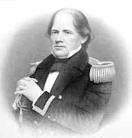
Matthew Fontaine Maury
The New York Times recently featured an article, Catching a Wave, and Measuring It, about a project to send a “fleet of robots that move out in the ocean to measure everything from weather to oil slicks, sharply reducing many of the costs of ocean-related businesses.” The Wave Glider robots, developed by James Gosling’s Liquid Robotics, are a marvel of technology. “Using a wave-based propulsion system and two solar panels to fuel its computers, the robots travel slowly over the ocean, recording data. The sensor data is crunched onboard by low-power cellphone chips, and then shipped by satellite or cellphone to big onshore computers that do complex analysis.”
The first sentence of the New York Times article reads, “James Gosling wants to network the world’s oceans.” The truth is that Matthew Fontaine Maury beat him to it and he did so in the 1850s.
In 1847, Lieutenant Matthew Fontaine Maury published his first Wind and Current Charts of the North Atlantic, and by 1848 he completed Wind and Current Charts of the South Atlantic, the North and South Pacific and the Indian Ocean. They created a sensation in the shipping industry. With Maury’s WInd and Current Charts, the captains of clipper ships could cut days and weeks off their transits across oceans.
How did Lieutenant Maury, without the aid of robots, satellite communication, or computers, manage this feat? He started by consulting thousands of ships logs and charts. Sailing ship captains, being entirely dependent on the wind, logged wind direction and speed in considerable detail in their deck logs. Maury discovered a trove of old logs that were about to be thrown away, which would prove invaluable.
That was the only the beginning, however. Maury proposed that all merchant ships be provided with charts of sailing directions, “on which should be daily registered all observable facts relating to the winds, currents, and other phenomena of importance and interest, for the foundation of a true theory of the winds.” His proposal was gradually adopted by US shipowners and at an international conference in Brussels in 1853, Maury proposed that ships of all flags would benefit by systematically recording winds and currents. Within a few years, three fourths of world shipping was sending their oceanographic observations to Maury at the Naval Observatory, where the information was evaluated and the results given worldwide distribution.
In The Clipper Ship Era – An Epitome of Famous American and British Clipper Ships, Their Owners, Builders, Commanders, and Crews, 1843-1869, by Arthur Clarke, he writes:
In 1856 the captains and officers of a fleet of no less than a thousand merchant ships, sailing under the United States flag upon every sea and ocean, were recording daily and almost hourly observations of the winds and currents. Under the British flag were to be counted the whole Navy of Great Britain and over one hundred merchantmen ; under the flag of Holland, two hundred and twenty-flve merchant ships and those of the Royal Xavy. Besides these there were the ships of France. Spain, Portugal, Italy, Belgium, Prussia, Denmark, Sweden, Norway, Russia, Chili, Bremen, and Hamburg, all co-operating and assisting this great scientist in his noble work.
The reason that so many shipowners participated in Maury’s work was practical as well as scientific.
Clarke writes:
Maury’s researches had, however, a very practical aide to them. Hunt’s Merchants’ Magazine for July – May, 1854, states that on the outward passages alone from New York to California, Australia, and Rio Janeiro, American ships, through the use of Maury’s Sailing Directions, were saving in time the sum of $ 2,250,000 per annum, and it is probable that could an estimate have been made of the saving in time to all of the ships using the Sailing Directions, the total amount must have considerably exceeded $10,000,000 per annum.
It should be remembered that this result had been accomplished without expenditure of money, beyond the moderate salaries of Maury and his staff of assistants, and the insignificant cost of printing the blank log-books, charts, and sailing directions.
Sea-captains of all nations regarded Lieutenant Maury as a wise counsellor and faithful friend, while France, Holland, Sweden, Spain, Italy, Russia, Prussia, Austria, Portugal, and Sardinia, all either conferred upon him orders of knighthood or struck medals in his honor.
Matthew Maury’s example should remind us that not all networking need to be electronic.
