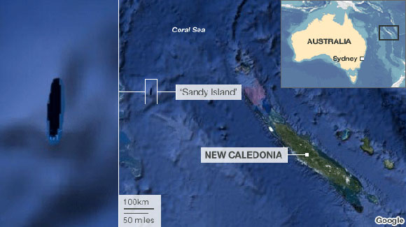
 Scientists from Australia have just returned from a voyage of un-discovery. They have proven that Sandy Island, which appears on many nautical charts and on Google Earth and Google Maps, does no exist. The island which is depicted on Google Earth as a dark oval, roughly 14 nautical miles long by 3 miles wide in the Coral Sea between New Caledonia and Australia, simply isn’t there. Instead they found water over 4,600 feet deep. Sany Islad has apparently appeared with some regularity on marine charts since at least 2000. The un-discovery took place onboard the RV Southern Surveyor, Australia’s Marine National Facility research vessel, during a 25-day research trip in the eastern Coral Sea. Thanks to Alaric Bond, Phil Leon and Erik Abranson for pointing the storyout.
Old Salt Blog
a virtual port of call for all those who love the sea , hosted by nautical novelist Rick Spilman

What an interesting story! I wonder how it was undiscovered for so long? Could this be an argument for “global warming”? Ha.. Thanks for sharing the news.
I’ve found mistakes on Gmaps in my own city and I alert them about it and they fix them.
However, some map makers add things into maps (errors) on purpose. They do this as a way to catch people who try to steal and profit from their maps and the errors are a way to catch the criminals.